Free Consultation
in Chicago & Across Northern Illinois
in Chicago & Across Northern Illinois
Free Consultation
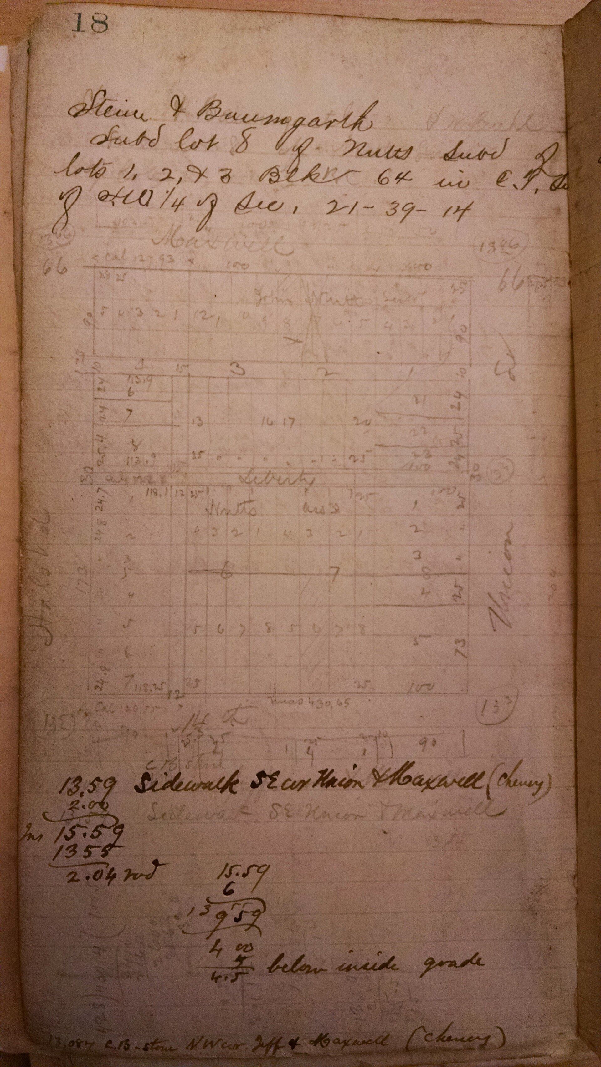
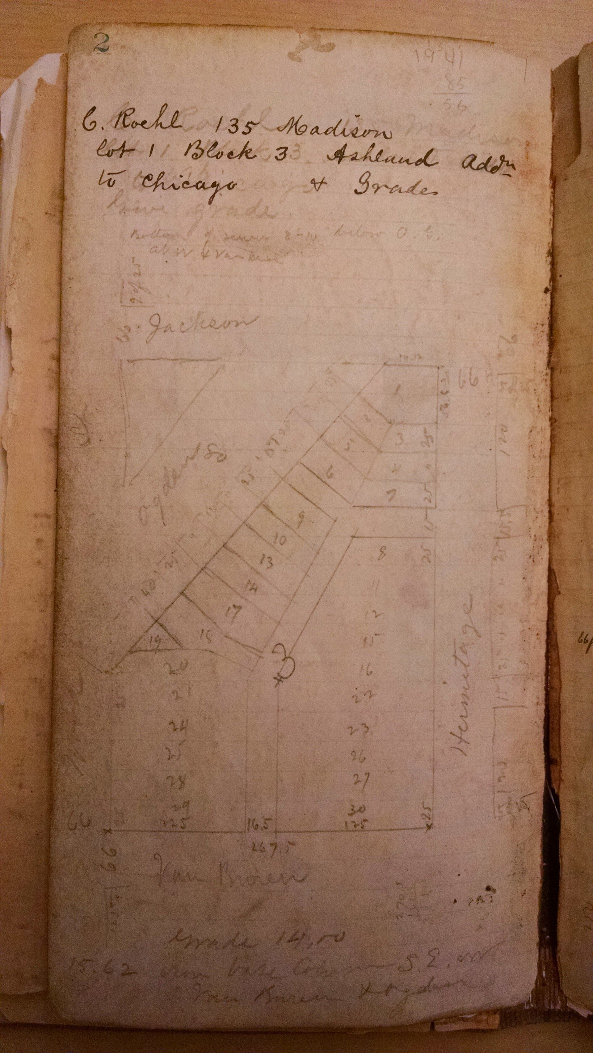
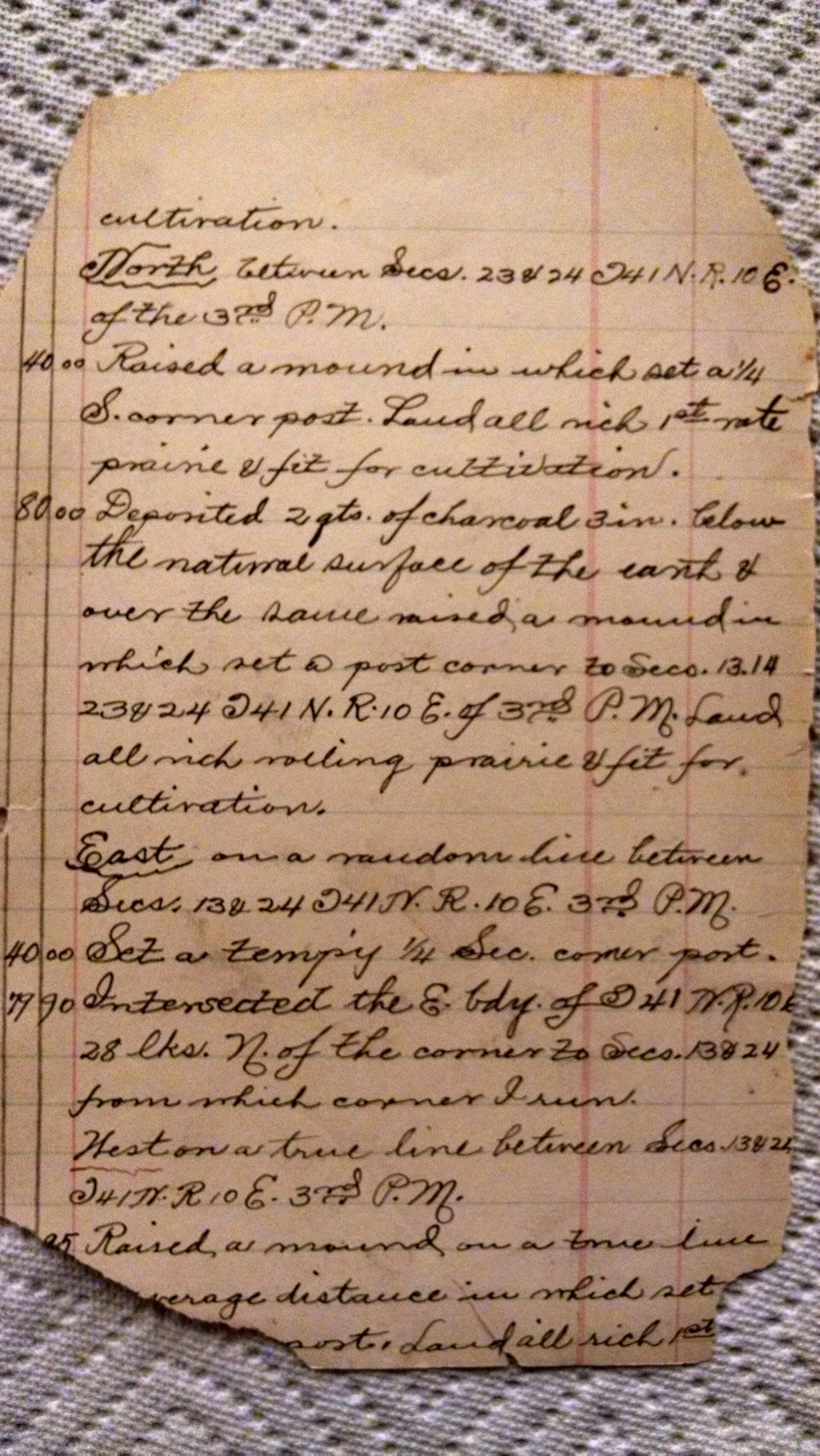
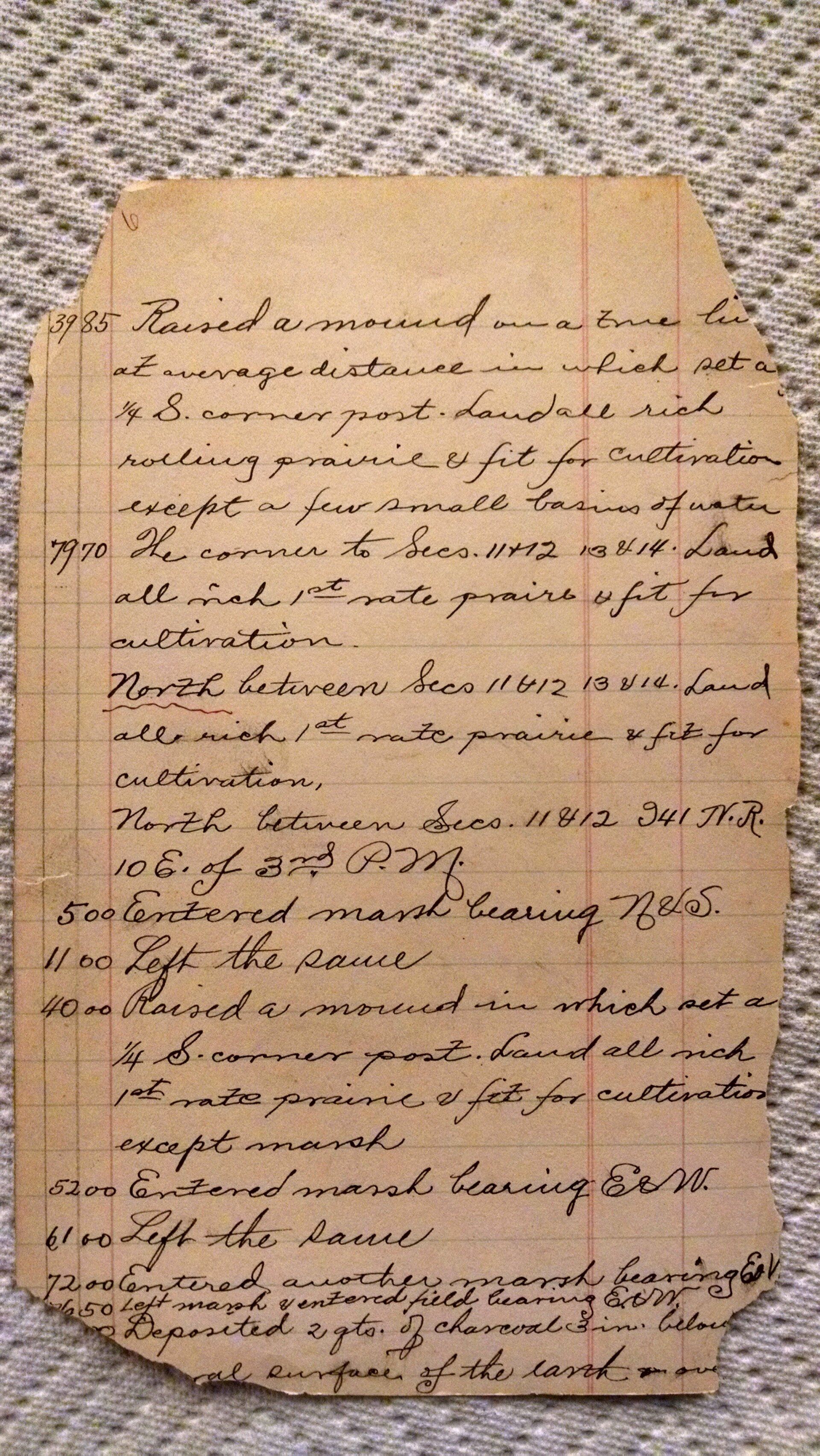
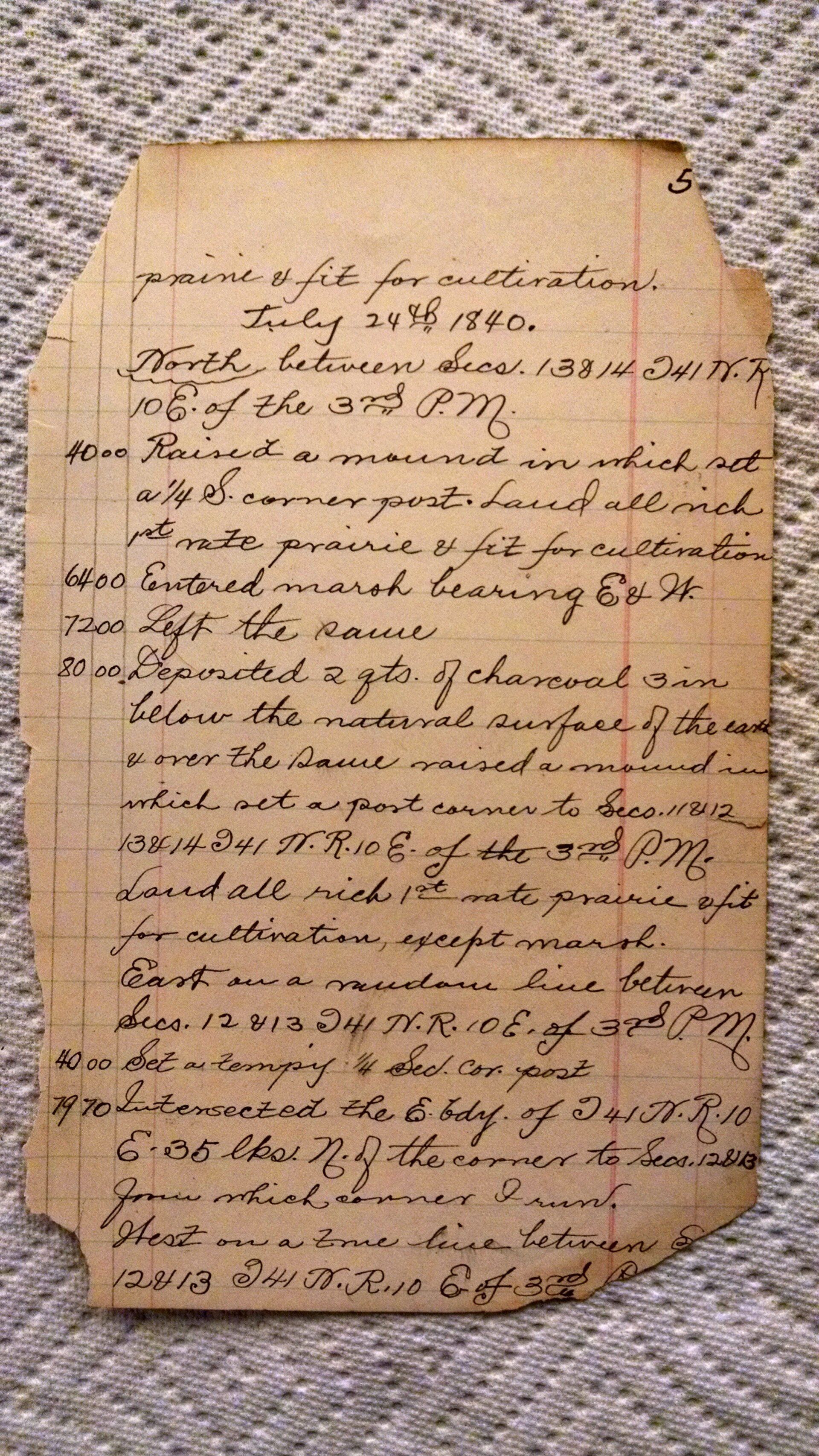
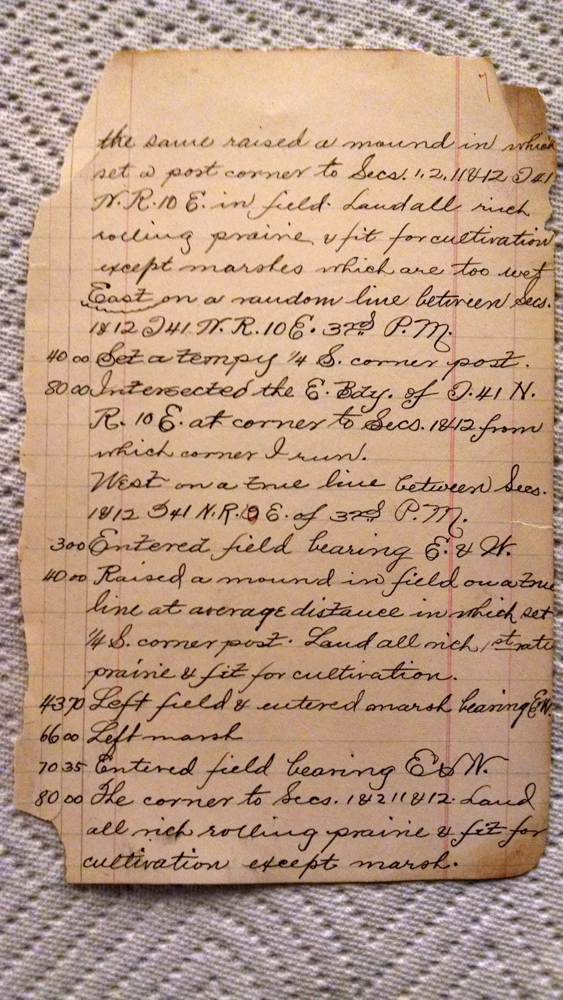
This one seems kind of overwhelming at first. The pages are so battered and torn that it is hard to decipher some of what is going on.
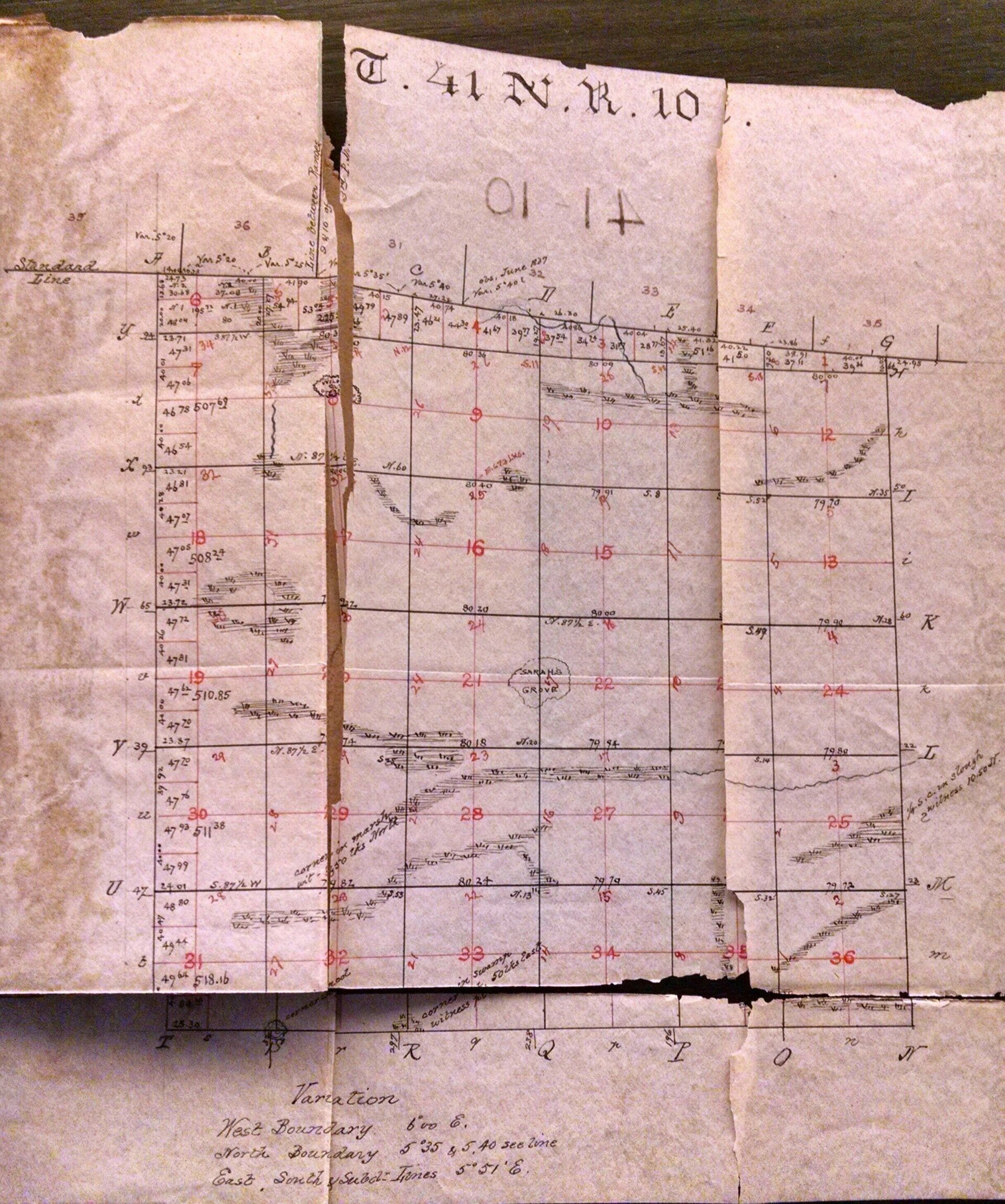
What I do know is that this is a survey of Township 41, Range 10 and I presume to be a full breakdown of the township.
I will do my best.
What I can see is that the surveyor measures just about 80 chains or 5280 feet for each section and I am curious as to how these measures where made. As you can see, most of Schaumburg was marshland at this time.
Sections were surveyed from south and east to the north and west the sections got narrower on the north end, being the reason for the errors distributed on the north end of the township. You can see this at the top of the sketch.
Lets see this error in sections with a more current example:
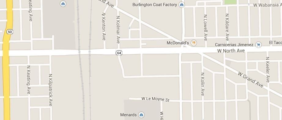
As you can see all of the streets above North Ave. are offset to the East a bit just as we see in the sketch of the Township.
Lets now try to decipher the running notes. I dont think that I put them in the correct order.
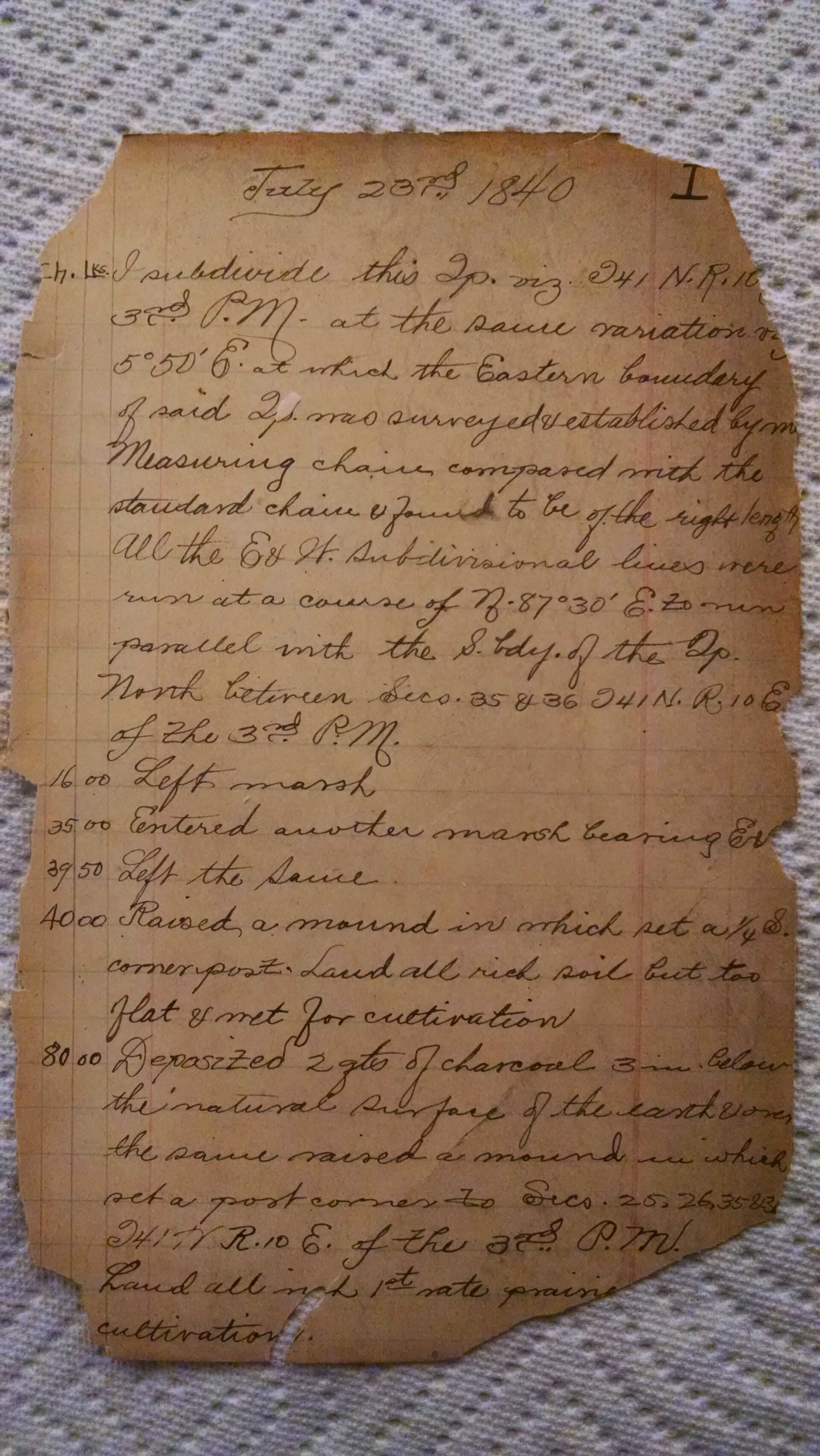
“I subdivide this township 41 Range 10 of the 3 principal meridian at the same variation of 5 degrees, 50 minutes at which the eastern boundary of said township was surveyed established by measuring chain and compared with the standard chain found to be of the right length. All the east and west subdivisional lines were run at a course of N 87 degrees 30 minutes East and run parallel with the south boundary of the township. North between sections 35 and 36 T41 north R10 east of the 3rd principal meridian.
16.00 chains= Left Marsh
35.00 chains= Entered another marsh bearing east
39.50 chains= Left the same as above
40.00 chains=Raised a mound in which set a quarter S corner post. Land all rich soil but too flat and met for cultivation.
80.00 chains= Deposited 2 quarts of charcoal 3 inches below the natural surface of the earth and one the same raised a mound in which I set a post corner to Section 25,26,35 and” 30 something I cannot make out due to the lack of paper.
Land all rich in 1st rate prairie cultivation.”
Just noticed a notation in the township sketch that indicates “Sarahs Grove” did a map search:
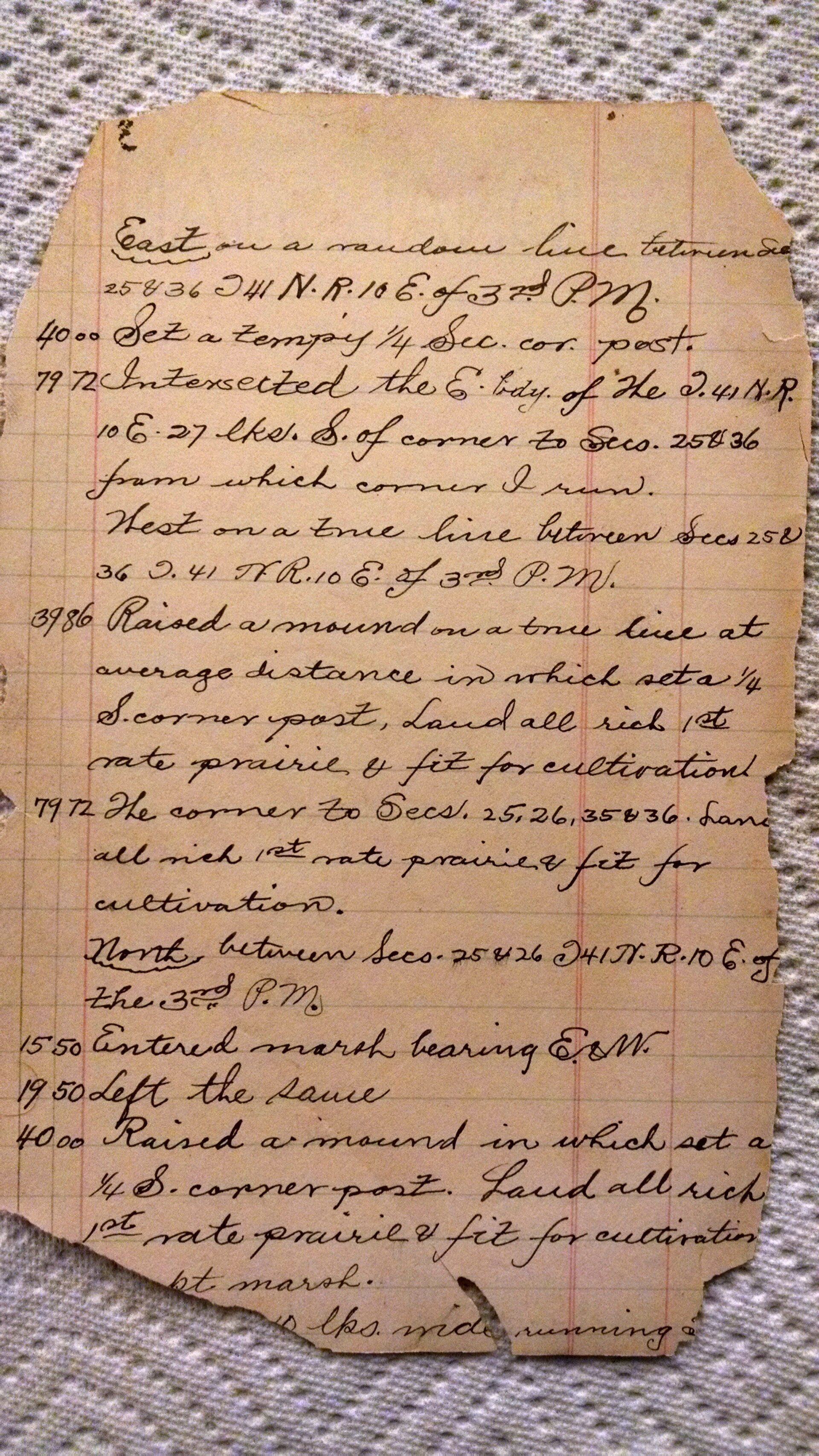
” East on a random line between sections 25 and 36 T41…..
40.00 chains= set a temporary quarter section corner post
79.72 chains= Intersected the east boundary of the T41 N R 10E, 27 links South of corner to sections 25 and 36 from which corner I run. West on a true line between sections 25 and 36″ again notating the township and range.
“39.86 chains= raised mound on a true line at average distance in which I set a quarter South corner post, land all rich in 1st rate prairie and fit for cultivation.
79.72 chains= the corner to sections 25,26,35 and 36. Land all rich in 1st rate prairie and fit for cultivation.”
Thence
“North between sections 25 and 26” again noting the townshiptownship and range.
“15.50 chains= Entered marsh bearing east and west
19.50 chains= Left the same
40.00 chains= Raised a mound in which I set a quarter south corner post. Land all rich with 1st rate prairie and fit for cultivation.”
The rest of the page is torn and illegible.
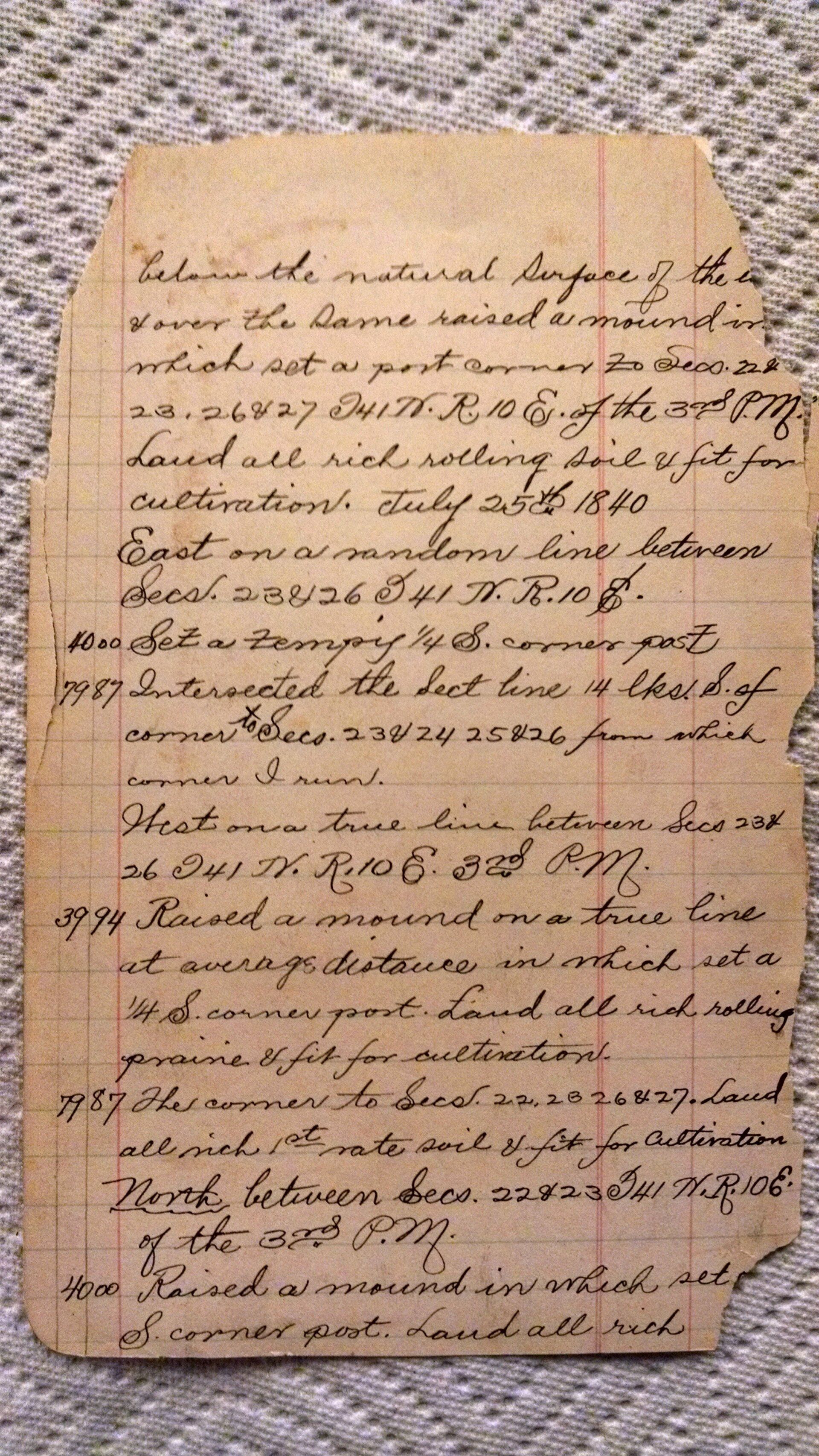
Continued run:
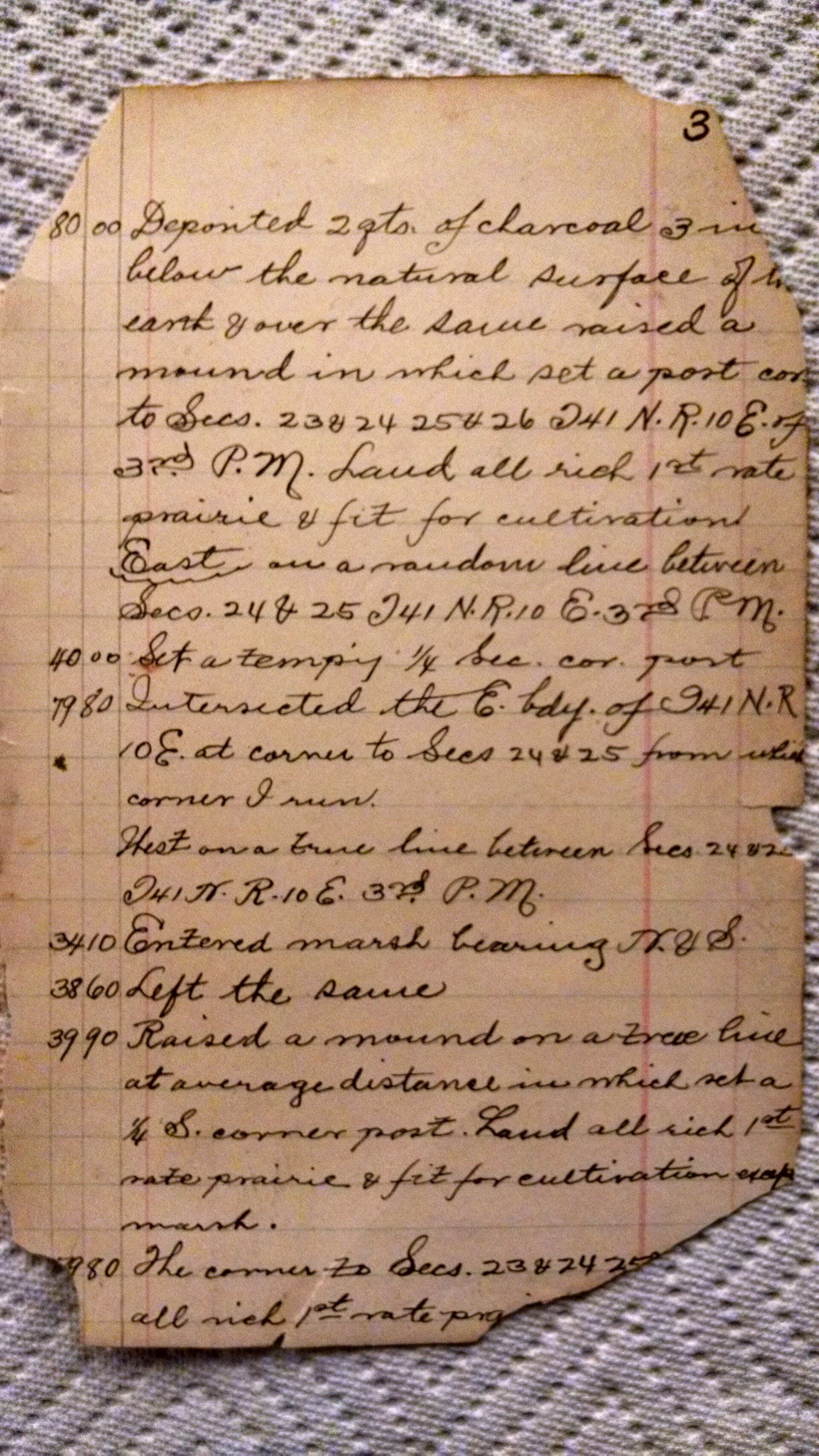
“80.00 chains= deposited 2 quarts of charcoal 3 inches below the natural surface of the earth and over the same raised a mound in which I set a post corner to sections 23, 24, 25, and 26 in township 41 N Range 10 east of the 3rd principal meridian.Land all rich in 1st rate prairie and fit for cultivation.”
Thence
“East on a random line between sections 24 and 25 T41N,R10E of 3rd PM.
40.00 chains= set a temporary quarter section corner post.
79.80 chains= Intersected the east boundary of T41N,R10E at corner to sections 24 and 25 from which corner I run.
West on a line between sections 24and 25” 25 I think, paper is torn.
“34.10 chains= entered marsh bearing north and south
38.60 chains= Left the same
39.90 chains= Raised a mound on a tree line at average distance in which ate a quarter south corner post. Land all rich in 1st rate prairie and fit for cultivation.”
The rest of the page is torn in undecipherable.
The remaining pages seem to be very similar in describing the distances the surveyor measured to the particular types of land found along said measures. This is true, in its definition, surveying the land.
In a modern day scenario it is very similar, only the objects being described are more established and, most of the time, surveyed/documented once before. Lets roll on to the last page and see if that has a different story than the last couple of pages.
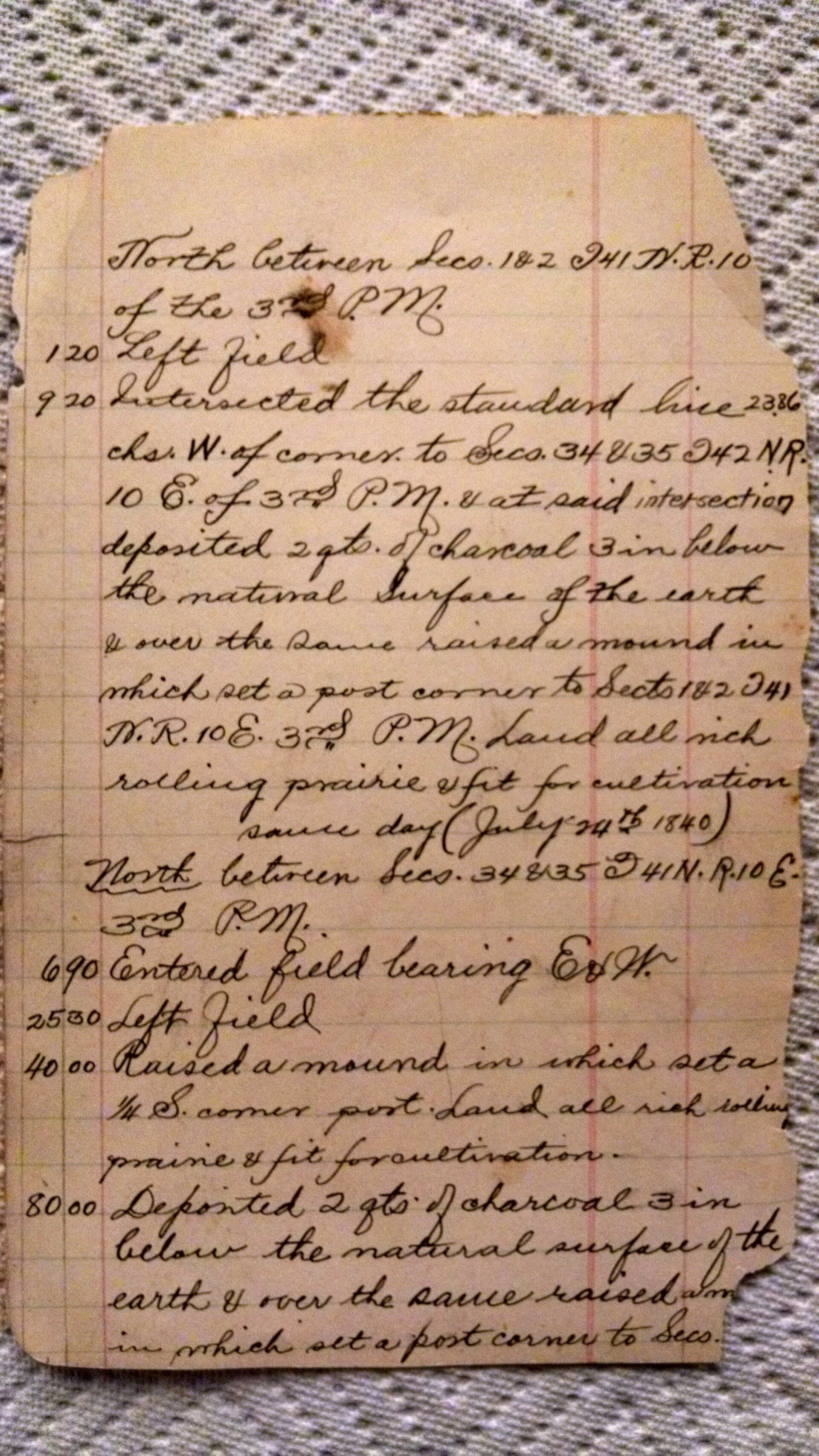

As we can see the last page is the same as all the rest, raising a mound and depositing charcoal. Although you may think that these notes are repetitive and inconsequential, they hold a key into the past that determine the outcome of future boundaries in the area and, at times, hold precedence in land disputes.